Black Sea Coast
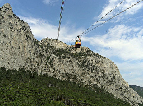
Ai-Petri is a peak in the Crimean Mountains. For administrative purposes it is in the Yalta municipality of Crimea. Ai-Petri is one of the windiest places in Ukraine. The wind blows for 125 days a year, reaching a speed of 50 m/s (110 mph). The peak is located above the city of Alupka and the town of Koreiz.
Charax is the largest Roman military settlement excavated in the Crimea. It was sited on a four-hectare area at the western ridge of Ai-Todor, close to the modern tourist attraction of Swallow's Nest.
The " Kichkine ” Palace (from the Persian word for a baby) was built between 1908 and 1911 on Cape Ai-Todor in Gaspra by three brothers Trasov - local architect, designer, furniture manufacturer.
Dulber is a palace in Koreiz, near Yalta in the Crimea. The palace of Grand Duke Peter Nicolaievich of Russia, known as Dulber (dülber is Crimean Tatar for "beautiful"), is an asymmetrical architectural extravanganza with crenellated walls, silver domes, and more than 100 rooms, inspired by the Mameluk architecture of 15th-century Cairo. This palace was built between 1895 and 1897.
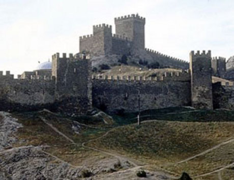
Sudak or Sudaq is a small historic town located in Crimea, Ukraine situated 57 km (35 mi) to the west of Feodosiya (the nearest railway station) and 104 km (65 mi) to the east of Simferopol, the capital of Crimea. Today it is a popular resort, best known for its Genoese fortress, the best preserved on the northern shore of the Black Sea.

Balaklava is a former city on the Crimean peninsula and part of the city of Sevastopol which carried a special administrative status in Ukraine, but is now part of Russia. It was a city in its own right until 1957 when it was formally incorporated into the municipal borders of Sevastopol by the Soviet government. It also is an administrative center of Bakalava Raion that is used be part of the Crimean Oblast before it was transferred under the Sevastopol Municipality.
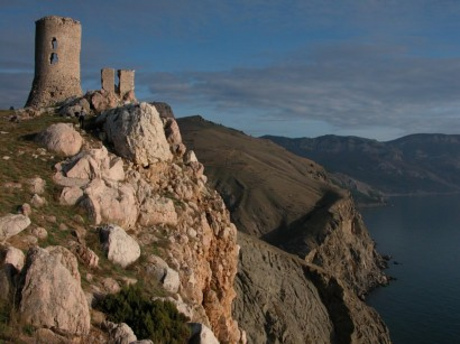
The fortress of Cembalo is located atop Kastron mountain in the south-east coast of the Bay of Balaklava, 12 km far from the historical center of the city of Sevastopol. Nowadays, modern Balaklava is a district of the present Sevastopol offering a beautiful site of the Crimean seashore with specific climate and landscapes, as well as interesting historical monuments.
The Kara-dag reserve on the coast of Crimea, between the village of Kurortnoye and the resort of Koktebel, is one of those places where, whatever your religion, you can feel the hand of the Creator at work. Indescribably beautiful, this unique Jurassic landscape is the result of an extinct volcano, which thousands of years ago spewed lava and debris into the sea. The elements have weathered the volcanic rocks into fantastic shapes and produced flora and wildlife unique to this part of Crimea.
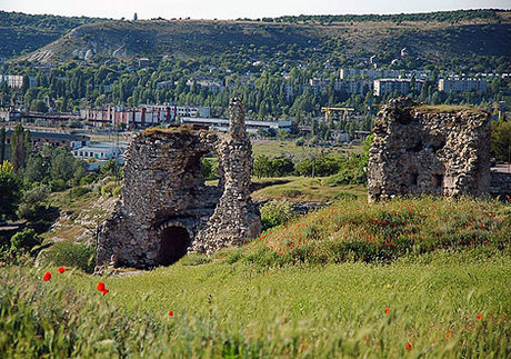
The fortress of Kalamita or Inkerman is located in the estuary of Chernaya (Russian for "black") river, on the plateau of Monastyrskaya Skala ("monastery cliff" in Russian). In the 6th century, a Byzantine fortification was erected there and garrisoned with local dwellers, similarly to what happened in the other sites of the mountainous part of the Crimea.
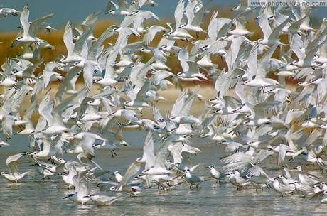
The Swan Islands (Sari-Bulat) are situated on the Northern-Western beaches of the plain Crimea at a distance of 3,5 km from the seashore in the Karkinit Bay. All the islands stretch along the bay-shore for 8 km. The biggest island of the six ones is the fourth, 3,5 km long and 350 metres wide. The extensive forbidden zone has been founded. The Swan Islands are reservation of the international importance.
 1 2 34 5 6