Ukraine
Ukraine

Balaklava is a former city on the Crimean peninsula and part of the city of Sevastopol which carried a special administrative status in Ukraine, but is now part of Russia. It was a city in its own right until 1957 when it was formally incorporated into the municipal borders of Sevastopol by the Soviet government. It also is an administrative center of Bakalava Raion that is used be part of the Crimean Oblast before it was transferred under the Sevastopol Municipality.

When you happen to get to Karasan (the former Rayevsky’s estate), first of all you should look around the well-known Yuzhnoberezhny (Southern coast) Park.

Driving out on an Alushta route, it wouldn’t be a bad thing to drop in at a place of the old Chatyr-Dag. It is the best-known mountain range in the Crimea, which is included in the highest five ones on the peninsula. The peak of the overhead plateau is 1525 meters above sea level! From a distance the outlines of the mountain range remind a tent or a marquee; the name Chatyr-Dag derives from here, meaning a «tent-mountain» in translation from Turkic.

There is a historic landmark on a quiet street in Yalta, formerly Leszczynski’s mansion. The ground floor hosts the exposition “Yalta: Culture at the Turn of the 20th Century.” The second floor accommodates a literary museum dedicated to the prominent Ukrainian poet, Lessya Ukrainka (Larysa Kosach-Kvitka), which opened on February 25, 1991, in commemoration of her 120th anniversary, and focuses on the time she spent in this scenic resort city, and the work she accomplished in that period.
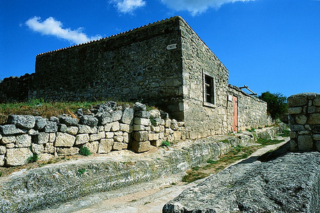
The limestone escarpments around Bakhchisarai are riddled with caves, which served as home to neolithic inhabitants long before the first recorded settlements. The remains of Chufut-Kale (`Jewish fortress') lie at the head of a steep-sided valley on the outskirts of Bakhchisarai, about a mile's walk from the Khan's Palace.
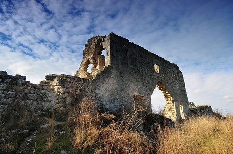
Mangup-Kale, the most outstanding of all the Crimean "cave towns", greatly impressed travelers through many centuries. It is located on the mountain plateau of the same name about 600 m above sea level. From three sides, it is limited by vertical precipices 40-70 m high, though its northern slope is cut through by three deep ravines: Tyshkli-Burun (Tatar for "promontory of holes"), Elli-Burun ("promontory of winds"), and Chufut-Cheorgan-Burun ("promontory of the Jews' challenge").
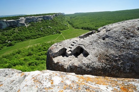
Medieval site of Tepe-Kermen (Tartar for "fortress on a summit") is located in the vicinity of the present city of Bakhchisaray, at the top of a mountain which raises on 540 m above the sea level. On its south and west, there are precipices up to 12 m high.
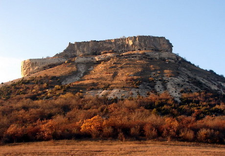
Eski-Kermen is one of the most picturesque cave towns. It is located in the south-western area of the mountainous region of the Crimea, 6 km to the south from Krasnyy Mak (Russian for "red poppy") village, on the plateau of a mesa, which stretched along the north-south axis. This plateau is 1,040 m long and maximum 170 m wide. Its north and east slopes had steep precipices rising up to 30 m high above neighboring valleys.
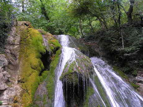
Dzhur-Dzhur Falls are the most powerful and inimitably scenic waterfalls in Crimea. Located not far from Alushta, they are on the southeastern slopes of Demerdji Mountain. Even in the driest years, Dzhur-Dzhur continues to flow. Breaking into a thousand separate jets, the mass of water rushes down in a powerful current some 15 meters, crashing onto a limestone ledge and spraying visitors with refreshing tiny droplets of water. The name translates from the Crimean Tatar language for 'purl'. It formed East Ulu-Uzen river, that's used for the water supply system of Alushta town.

Golitsyn Path begins on the south-western coast of the Green Bay under the northern slope of Khoba-Kaya mountain range and ends near the western entrance to Through Grotto. Bending round the cape, the path leads to the one of the Wonders of Noviy Svet – a giant natural grotto breached through the rocks by the sea waves. There is a huge stone lump in the sea under the grotto vault, which one day fell down from the “ceiling”. This stone is known nowadays as “the Turtle”. There is a through underwater tunnel under the grotto. From the cool grotto the path leads to the west, towards southern slopes of Khoba-Kaya. In the ravines one can see remains of coral fossils, sea-urchins and seaweeds which lived here 150 million years ago in the warm Jurassic ocean.
 1 2 3 4 5 6 7 8 9 10 11 1213 14